Overview
What’s about Final Surface?
Final Surface is a high quality software product for professional acquisition, visualization, editing and analysis of complex 3d data in form of point clouds and triangle meshes. You can import data of different 3d measuring systems of various vendors and from CAD software. The software contains a variety of professional tools and algorithms for the analysis and processing of 3D data.
Final Surface is developed and published by the Society for the Promotion of Applied Computer Science (GFaI e.V.) based in Berlin, Germany.
Functional range of Final Surface
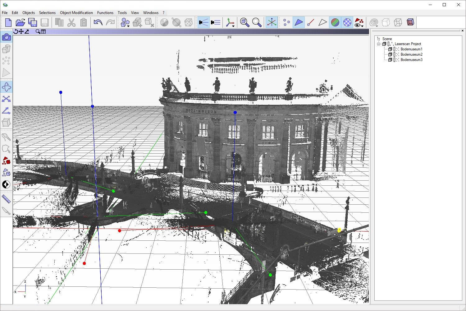
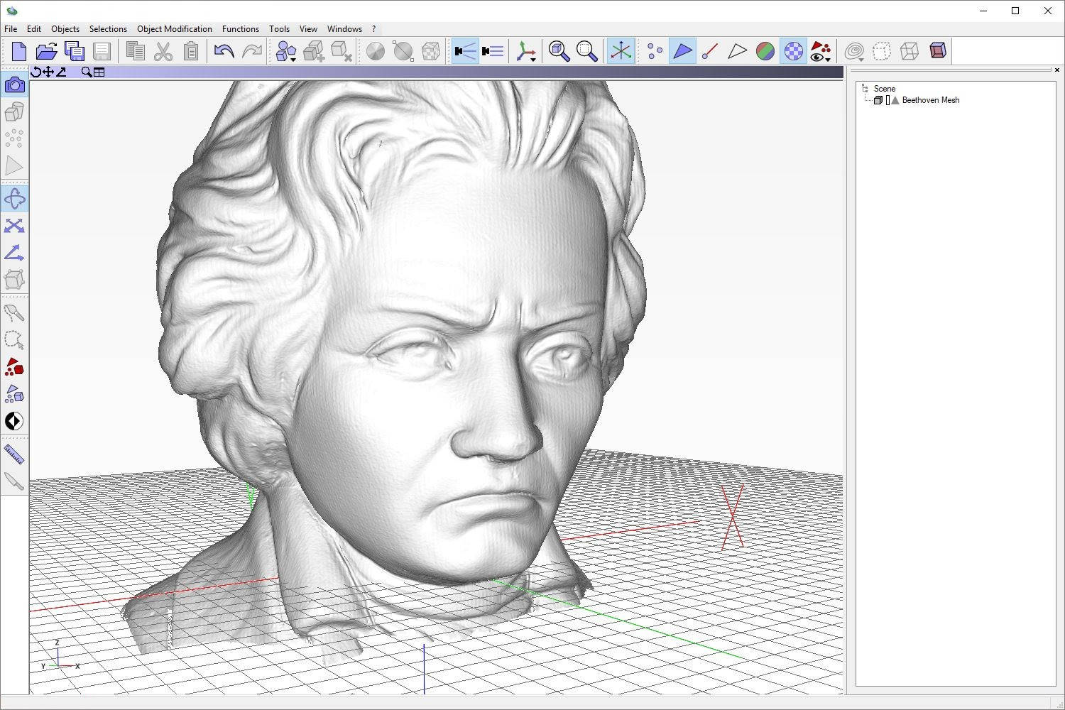
- 3D visualization of point clouds and triangle meshes
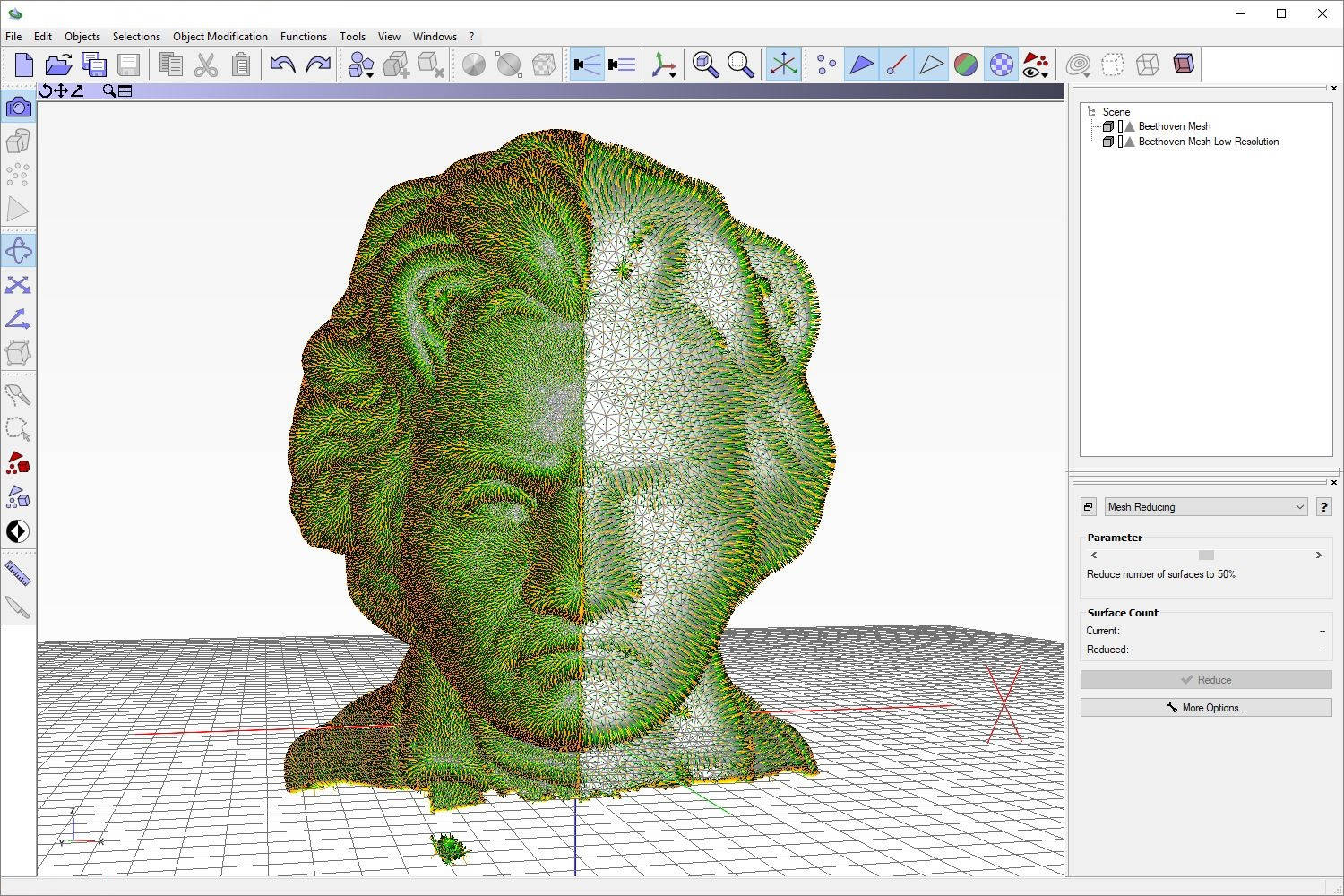
- Surface generation and processing of 3D point clouds
- Analysis and editing of triangle meshes
- Professional 3D data analysis
- Versatile import and export functions
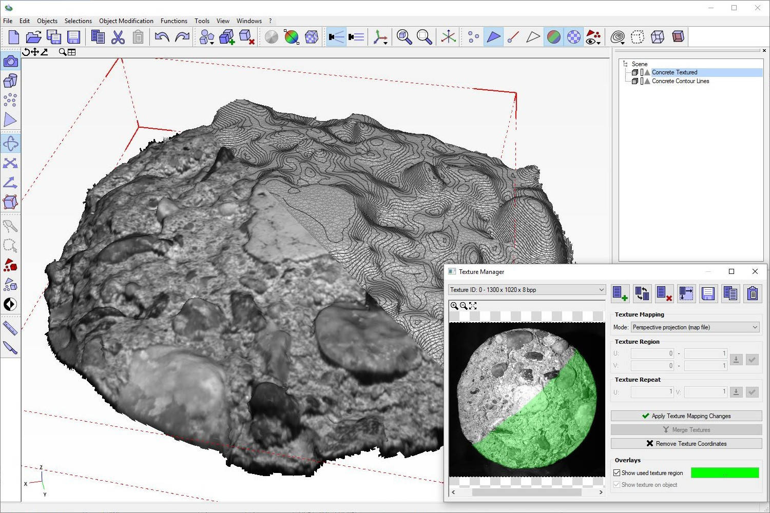
- Interactive tools (e.g. cut tool, colorize by gradient, texture manager)
- A large number of optional extension modules
- The user interface can be displayed in German and English
Gallery
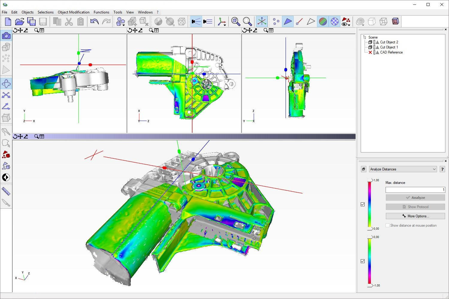
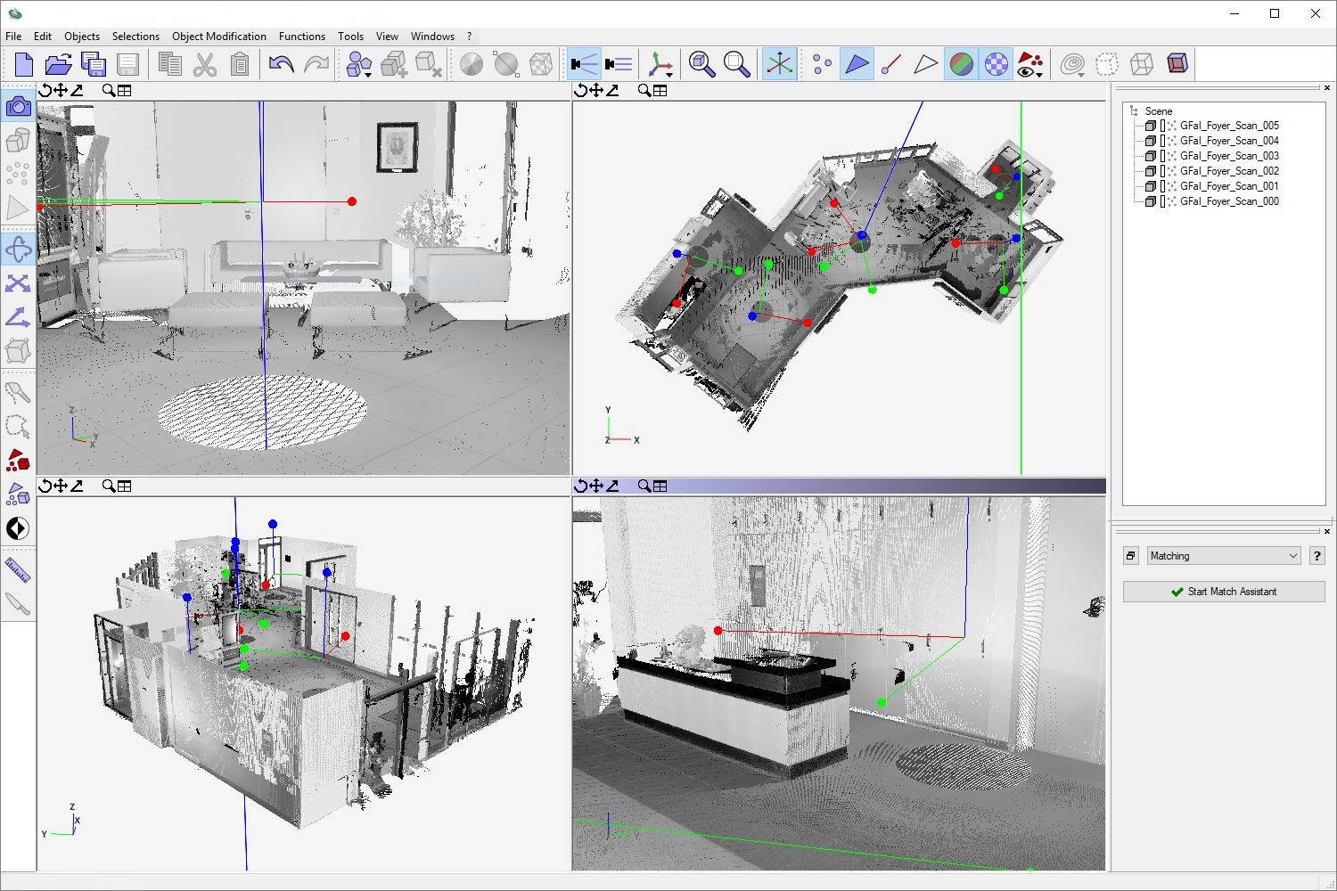
Analyze, Measure, Visualize
The 3D software Final Surface provides you with extensive analysis, measuring and viewing functions to check and evaluate your data sets:
- Representation of contour lines and clip views
- False color visualization of point clouds and triangle meshes according to their geometric distribution
- Detect invalid neighborhoods and wrongly oriented triangles
- Detect articulation points and double points
- Measure distances and angles between individual objects
- Calculating geometrical objects and analytical geometries from 3D data (spheres, cylinders, planes, spline curves)
- Calculate intersection points, angles, volumes and surface areas of objects
Supported 3D file formats
| Format | Import | Export | Bezeichnung |
|---|---|---|---|
| 3D PDF | x | 3D Portable Document Format | |
| 3DS* | x | x | 3D Studio Format |
| AMF | x | x | Additive Manufacturing File Format |
| ASC, XYZ, TXT | x | x | Ascii Format |
| SCN, BSCN | x | x | GFaI Scene Format |
| CAD | x | CAD File Format | |
| CNK, BCNK | x | x | GFaI Chunk Format |
| CSV, TSV | x | x | Comma-/Tab Separated Format |
| DXF* | x | x | Drawing Interchange Format |
| E57¹ | x | x | E57 Laserscan Format |
| FAC | x | GFaI FAC Format | |
| FLS¹, FWS¹, LSPROJ¹ | x | FARO Laserscan Format | |
| GTS | x | x | GNU Triangulated Surface |
| IGS², IGES² | x | Initial Graphics Exchange Specification | |
| LAS¹, LAZ¹ | x | LIDAR Format | |
| MDL | x | x | GFaI MDL Format |
| NMDL | x | GFaI NMDL Format | |
| NDF | x | GFaI Raw Scan Data Format | |
| OBJ | x | x | Wavefront OBJ |
| OFF | x | Object File Format | |
| PLY | x | x | Polygon File Format / Stanford Triangle Format |
| POV | x | POV-Ray Format | |
| PTS¹ | x | x | PTS Leica Laserscan Format |
| PTX¹ | x | PTX Leica Laserscan Format | |
| PTG¹ | x | x | PTG Leica Laserscan Format |
| STL, STLA, STLB | x | x | Surface Tesselation Language / Standard Triangulation Language |
| STP², STEP² | x | STEP Format (Standard for the Exchange of Product Model Data) | |
| U3D | x | Universal 3D | |
| WRL | x | x | VRML 97 Format |
| XHTML, X3D | x | Extensible HyperText Markup Language / Extensible 3D Format | |
| ZFS¹ | x | Zoller+Fröhlich Laserscan-Format | |
| ZIP, GZ | x | x | Compressed ASC, XYZ, TXT, CSV, TSV Files |
* The signed file formats will import the relevant point and triangle data only
¹ Available via Laserscan File Formats extension module
² Available via CAD File Formats extension module